
At least three (and maybe more) tornadoes moved across Southwest Michigan on Tuesday. Fortunately, I have not seen any reports of fatalities. There were “16 to 20 injuries”. The two cities that appear hardest hit were Portage (just south of Kalamazoo) and Centreville (St. Joseph County).
The Kalamazoo County Sheriff’s Office said around 15 to 17 homes at the Pavilion Estates, a mobile home park in the Portage area, were destroyed. The sheriff’s office said 16 to 20 people were injured in Tuesday’s storms. Their injuries are not considered life-threatening. A local State of Emergency has been declared in Kalamazoo County.


Video of the Colon tornado from Luke Sharp

Substantial damage at a Fed Ex facility. Damage to a barbershop. Looks like at least EF2 damage.
Tornado video from Portage/Kalamazoo. Close-up of the Portage tornado.

SOFTBALL-SIZED HAIL AT UNION CITY!!
Check out the hail in the Chicago area. Hail video from near Chicago.

Storm Reports for May 7 Tuesday
Here’s the updated storm reports from the Storm Prediction Center for Tuesday May 7. They list 27 tornadoes. That includes 15 in southwest Michigan, 5 in Ohio, 4 in Indiana, 2 in Arkansas and 1 in West Virginia. Some of the reported tornadoes are duplicate sightings of the same tornado. Damage assessments and storm surveys by the National Weather Service will give us the actual number of tornadoes.

Here’s the Consumers Energy Outage Map as of 11 pm Tue. There were about 25,000 customers without power. The outages follow the tornadoes paths. The first tornado was on the ground from Van Buren Co. into Kalamazoo County, crossing US 131, but not I-96. A second twister began not too far north of the Indiana border and moved thru Centreville and generally between US 12 and M 60.


TWO TORNADO WATCHES WERE ISSUED – THE FIRST UNTIL 9 PM AND THE SECOND UNTIL 11 PM.
Egg-sized hail was reported in the Chicago southern suburbs – hail to nearly 1″ in diameter hit Midway Airport in Chicago.

This was the Severe Weather Outlook Map for Tuesday/Tuesday night. The Michigan tornadoes occurred in the Slight Risk Area.
Here’s the latest Grand Rapids NWS forecast discussion.
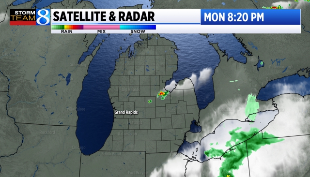
Here’s radar

Midwest radar
*****************************************************************************************************

On Monday THE STORM PREDICTION CENTER ISSUED A RARE HIGH RISK OUTLOOK AREA FOR SEVERE THUNDERSTORMS AND TORNADOES FOR SOUTH CENTRAL KANSAS AND CENTRAL OKLAHOMA (see map above).

As of 2:45 pm Tue. Update: The storm reports from Monday show 21 tornado reports in 7 states (8 in Oklahoma, 4 in Missouri, 2 each in S. Dakota, Iowa, Tennessee and Kansas, one in Nebraska. There were 304 reports of wind damage (82 mph at Chester OK) and 110 severe hail reports (4″ diameter hail near Moonlight KS). One fatality was reported in Oklahoma.
HIGH RISK AREAS ARE RARE. In 5 of the last 9 years, we have not had a single day with a High Risk Area. The most high risk days in a calendar year was in 2003 and 2010 when six days had a High Risk Area. The longest stretch without a High Risk Outlook was from June 2014 until January 2017.
In the 25 years from 2000 through 2024, there were a total of 66 days with a High Risk Area. That figures to an average of 2.6 days each year with a high risk area.
Regarding today, SPC says: “A regional outbreak of severe weather with multiple strong, long-tracked tornadoes, as well as very large hail and severe thunderstorm gusts, is expected over parts of the south-central Plains from this afternoon through evening.”
Some of the Oklahoma cities in the High Risk Area include Oklahoma City, Norman (where the Storm Prediction Center is located) and Moore, the only city on earth to have had two EF5 tornadoes. During the Moore tornado of 1999, a portable Doppler radar measured a wind speed of 301 mph, the fastest wind ever measured on Earth.
Here’s current severe thunderstorm and tornado watches, current meso-discussions, lightning data. Follow tornado coverage in Oklahoma on KFOR.
A PDS (Particularly Dangerous Situation) Tornado Watch was out for south central Kansas and western and central Oklahoma.
.”

This is the Severe Weather Outlook Map for Wednesday PM/night. There is a Moderate Risk Area (level 4) from SE MIssouri into Tennessee and Kentucky. . The Marginal Risk Area comes up to the Michigan border. SPC says: “Scattered to numerous severe thunderstorms appear likely Wednesday across from parts of the southern Plains into the mid Mississippi, Ohio, and Tennessee Valleys. All severe hazards, including tornadoes, very large hail and severe/damaging winds should occur. Some of the tornadoes may be strong.”
There is a chance of a non-severe storm in Lower Michigan.

On Thursday, severe storms are likely in Texas, across the South and along the East Coast from Georgia up to southern New Jersey. For Friday and Saturday, the cold front will be far enough south that the severe threat may be limited to Texas, the immediate Gulf Coast and Florida.
Again, SPC has a risk of a non-severe storm in Southern Lower Michigan.
****************************************************************************************************
There were (as I write this – this number will be revised May 8) exactly 300 tornadoes in the U.S. during the month of April. That’s the second highest total in any April since 1950.

The map above shows where the April tornadoes occurred. Even though 2024 was in 2nd place, it was still less than half the number of tornadoes that hit the U.S. in April 2011 (757).
From April 25-28, 2011, there were 343 tornadoes. On April 27, there were 199 tornadoes. Those twisters resulted in 318 fatalities in a 24-hour period.
On April 27 this year, we had the first EF4 rated tornado in over a year. The Marietta OK tornado, with winds up to 170 mph, was on the ground for 27 miles and was 1/2 a mile wide. It crossed I-35. There was one fatality and a number of injuries with this tornado and 4 storm-related deaths statewide. .

ALSO: Severe flooding in Brazil. At least 75 fatalities and 373 missing.


